3.2.16
Coastal Management Case Study - Holderness
Test your knowledge with free interactive questions on Seneca — used by over 10 million students.
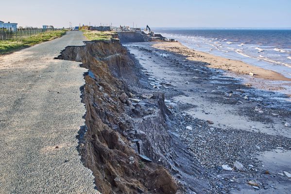
Coastal Erosion in Holderness
The Holderness coast is located next to the city of Hull in the north-east of England. Each year, the Holderness Coast retreats 1-2 metres. The area is particularly vulnerable to erosion because of:

Strong prevailing winds
- Strong prevailing winds create destructive waves that can do more damage to the coast.
- The prevailing winds also mean that any eroded material moves away from the place that was eroded (leaving the soft rock exposed).

Clay cliffs
- The Holderness Coast is made of boulder clay.
- This is very soft and easy to erode.
- Heavy rainfall can cause mass movements in the boulder clay cliffs.
Coastal Management in Holderness
In 1991, a £2 million project built rock groynes and rock revetments at Mappleton in the Holderness coast. These are examples of hard engineering.
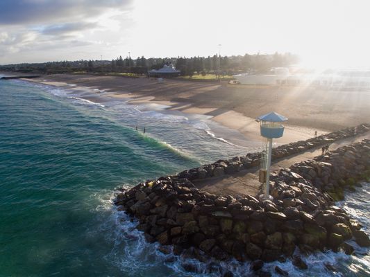
Rock groynes
- The rock groynes tried to stop sediment being carried away from the Holderness Coast and tried to create a larger beach to protect the land behind.
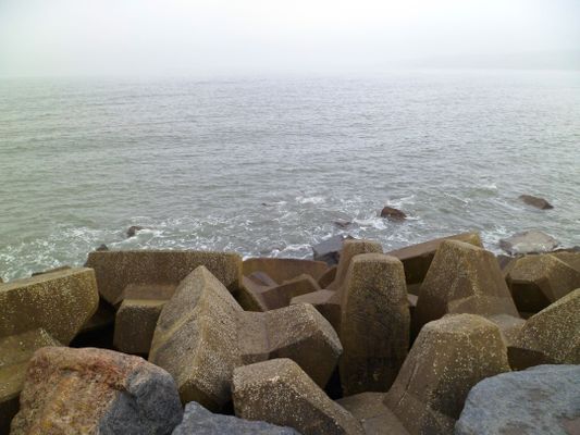
Rock armour
- Rock armour was placed at the foot of the cliffs.
- The rock armour is meant to absorb some of the waves' energy, instead of the coast or cliffs.
What are the Results & Effects of Coastal Management at Mappleton?
The cliffs at Mappleton now erode at 1-2 metres per year, instead of the 7-10 metres before 1991. Mappleton now has a larger beach, however, there have been some negative effects:
Area south of Mappleton
- The area south of Mappleton is experiencing faster coastal erosion as a byproduct.
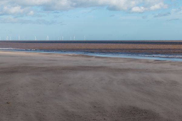
Spurn Point
- The Spurn Point area south, has become less secure.
- Less material is washed down the Holderness Coast.
- Some Hebridean Sheep were washed away and killed. People are now warned not to visit the Point at some times of year, or they too could be washed away.
Spurn Point lifeboat & visitor's centre
- £471,000 was spent on a visitor's centre which could become less accessible over time.
- Lifeboat services also operate from Spurn Point.
1The Challenge of Natural Hazards
1.1Natural Hazards
1.2Tectonic Hazards
1.3Weather Hazards
1.4Climate Change
2The Living World
2.1Ecosystems
2.2Tropical Rainforests
2.3Hot Deserts
2.4Tundra & Polar Environments
3Physical Landscapes in the UK
3.1The UK Physical Landscape
3.2Coastal Landscapes in the UK
3.3River Landscapes in the UK
3.4Glacial Landscapes in the UK
4Urban Issues & Challenges
4.1Urban Issues & Challenges
5The Changing Economic World
5.1The Changing Economic World
5.2Economic Development in the UK
6The Challenge of Resource Management
6.1Resource Management
6.2Food
6.3Water
6.4Energy
Jump to other topics
1The Challenge of Natural Hazards
1.1Natural Hazards
1.2Tectonic Hazards
1.3Weather Hazards
1.4Climate Change
2The Living World
2.1Ecosystems
2.2Tropical Rainforests
2.3Hot Deserts
2.4Tundra & Polar Environments
3Physical Landscapes in the UK
3.1The UK Physical Landscape
3.2Coastal Landscapes in the UK
3.3River Landscapes in the UK
3.4Glacial Landscapes in the UK
4Urban Issues & Challenges
4.1Urban Issues & Challenges
5The Changing Economic World
5.1The Changing Economic World
5.2Economic Development in the UK
6The Challenge of Resource Management
6.1Resource Management
6.2Food
6.3Water
6.4Energy
Practice questions on Coastal Management Case Study - Holderness
Can you answer these? Test yourself with free interactive practice on Seneca — used by over 10 million students.
- 1How far does the Holderness coast retreat every year?Multiple choice
- 2What are the cliffs of the Holderness coast made up of?Multiple choice
- 3
- 4Why is the Holderness coast so vulnerable to erosion?Fill in the list
- 5
Unlock your full potential with Seneca Premium
Unlimited access to 10,000+ open-ended exam questions
Mini-mock exams based on your study history
Unlock 800+ premium courses & e-books